South Korea Travel & Data Guide 2026: Autumn Foliage, K-Culture & eSIMs
By Abhishek Aggarwal (Travel & eSIM writer, MobiMatter)
· 10 min read
Autumn in Korea: Best Viewing Spots and Weather Prep
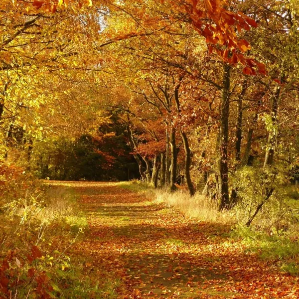
South Korea's 2026 foliage season runs roughly late September to mid-November, starting on the high northern slopes of Seoraksan and rolling south and downhill toward Seoul, Gyeongju, and Naejangsan over about six weeks. Korea's official 2026 foliage forecast from the Korea Forest Service is typically released in September, but the pattern repeats closely enough year to year to plan around. Color moves along two axes at once: north to south, and high elevation to low, which is why mountain parks turn weeks before city streets at the same latitude.
| Location | Typical peak window | Best for |
|---|---|---|
| Seoraksan National Park | Mid to late October | Dramatic mountain scenery, maple valleys |
| Namsan Park and Seoul city | Early to mid November | Ginkgo-lined streets, easy access without a day trip |
| Changdeokgung Secret Garden | Late October to early November | Palace grounds, advance ticket required |
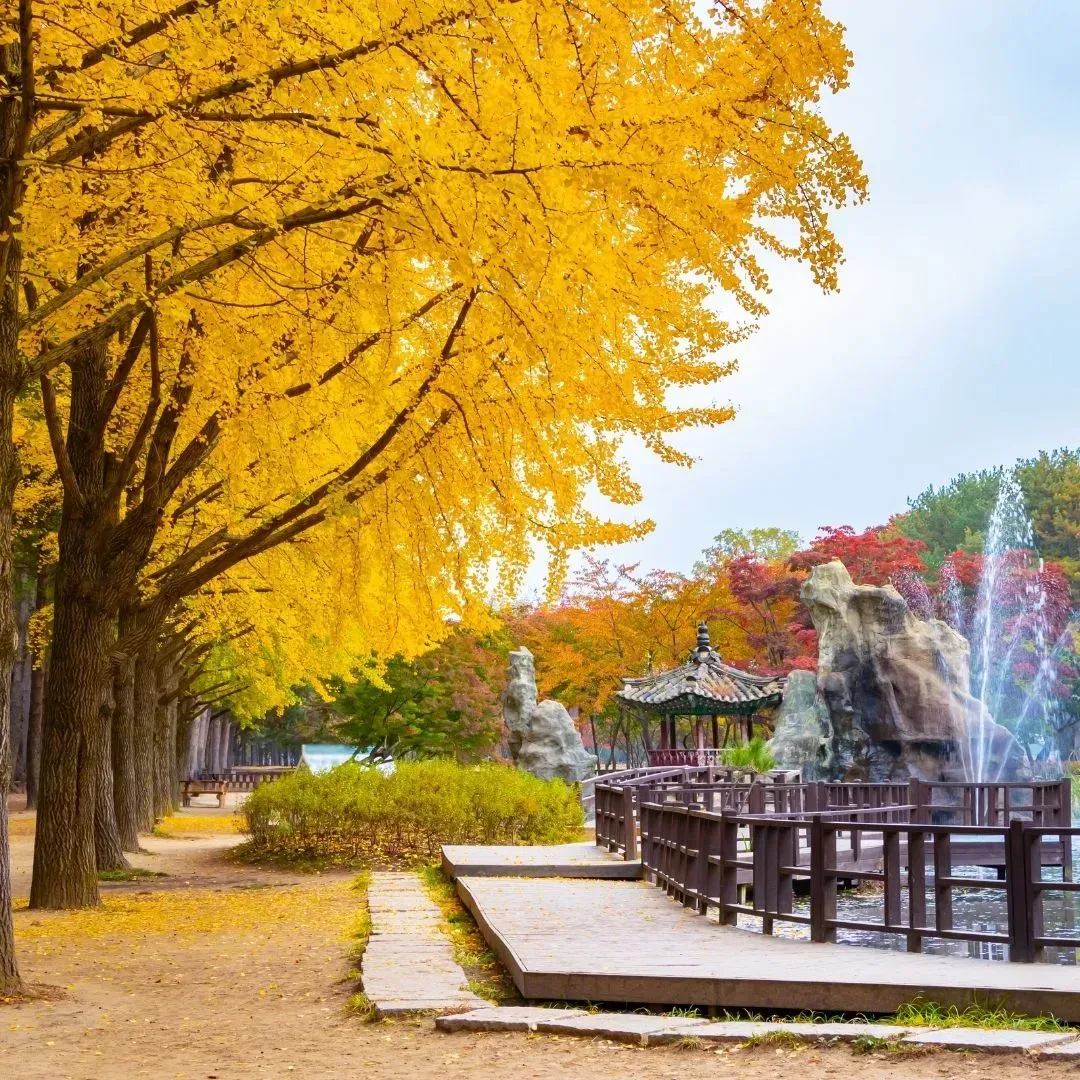
| Nami Island and Gapyeong | Late October to early November | Tree-lined paths, popular day trip from Seoul |
| Naejangsan National Park | Early to mid November | The most intense reds and golds in the country |
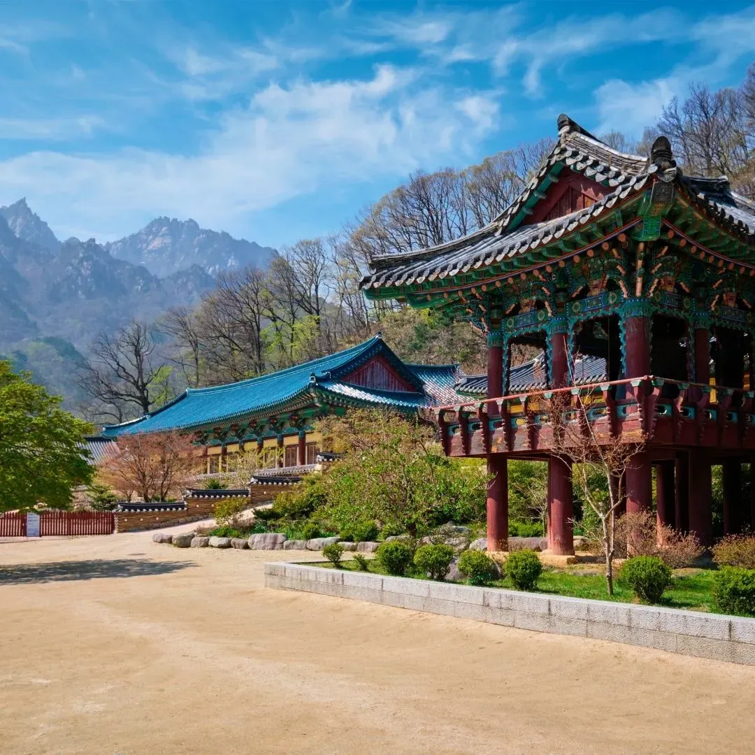
Seoraksan National Park is the earliest and most dramatic stop on any Korea autumn itinerary, and it's the one most travelers build their entire trip around. As a UNESCO-designated biosphere reserve straddling Gangwon Province's granite peaks, it offers a scale of mountain scenery that Korea's other national parks simply can't match. Its highest point sits above 1,700 meters, where temperatures drop fast enough in late September to trigger color change well before lower elevations catch up, which is why the park's upper slopes are often already deep in red and gold while Seoul's parks are still fully green. That elevation gap gives visitors a rare planning advantage: arrive slightly early for the coastal lowlands and the ridge above will already be turning, or arrive slightly late and the valley floors will have caught up to what the summit showed weeks before.
The park splits naturally into an easier half and a harder half, and most itineraries end up choosing one or combining both across two days. The Biseondae Trail is the easiest route for a half-day visit, following a gentle valley path past rock formations and shallow pools that make it accessible to most fitness levels and popular with families. For a bigger payoff with less walking, the Gwongeumseong cable car climbs toward the fortress ruins near the summit and delivers some of the widest panoramic views in the park, though queues on peak autumn weekends can run over an hour. More committed hikers push further into Cheonbuldong Valley for denser maple cover, following a longer, steeper route that trades convenience for the kind of unbroken canopy color that doesn't show up in the shorter walks. Some visitors extend even further toward Ulsanbawi, a dramatic exposed rock formation reached by roughly 800 steel steps, which rewards the climb with one of the most photographed views in the entire Korean park system.
Because Seoraksan sits close enough to the East Sea that Sokcho's beaches are only a short bus ride away, it's also one of the only major foliage destinations in this guide where a morning on granite ridgelines and an afternoon on the coast fit comfortably into the same day.
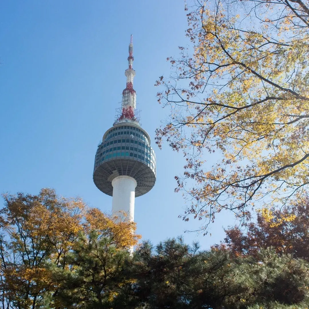
Namsan Park and the Seoul city center offer the most convenient foliage viewing for travelers who don't want to build a full day trip around it, and for anyone splitting a Korea itinerary between Seoraksan and the capital, this is where the trip winds down rather than ramps up. Namsan's wooded slopes rise right out of the middle of the city, reachable by cable car or a walking trail from Myeongdong, and the summit at N Seoul Tower gives a panoramic view over a city skyline framed by color rather than the granite ridgelines of the national parks further east. The park's maple and oak stands turn gradually through late October, giving visitors a longer, more forgiving window than the sharper seven-to-ten-day peaks found in the mountains.
Ginkgo avenues and palace grounds like Changdeokgung's Secret Garden peak slightly later than the mountains, typically in the first two weeks of November, which is part of what makes Seoul such a convenient closing stop on a foliage-focused trip: by the time the ridge parks have dropped their leaves, the city is just reaching its own peak. Deoksugung's Stone Wall Walk and the ginkgo-lined stretches around Olympic Park and Seoul Forest turn a deep, uniform gold during this window and are popular enough with locals that early morning or weekday visits noticeably thin the crowds. Changdeokgung's Secret Garden, a former royal retreat tucked behind the main palace halls, is widely considered the single best palace setting for autumn color in the city, with centuries-old trees framing ponds and pavilions in a layout that was deliberately designed to be walked through slowly rather than photographed from one spot.
Secret Garden tickets should be booked three to four days ahead since capacity is limited, as the site only admits visitors in small guided groups at fixed times throughout the day, unlike the rest of the palace grounds, which are open to unticketed wandering. During the first two weeks of November this ticket window tightens further, and same-day availability during peak color is close to nonexistent, so travelers building a Seoul stop around the Secret Garden specifically should treat that reservation as the anchor point around which the rest of the day is planned, rather than an afterthought squeezed in between other sights.
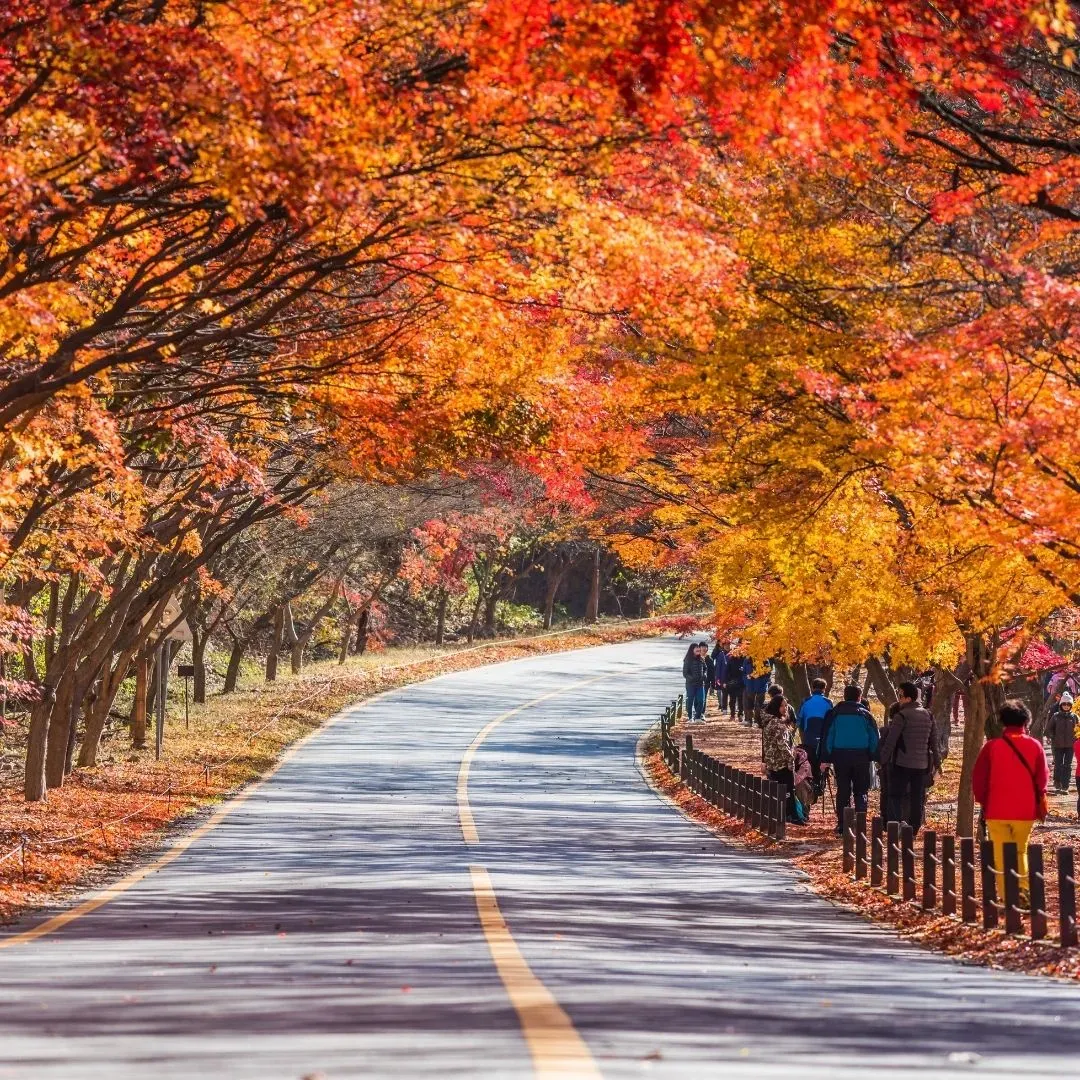
Naejangsan National Park, in the southwest, is reliably the last major stop of the season and often produces the most saturated color of any single park in the country. Expect long lines for the cable car to the summit during peak weekends.
Weather-wise, October in Korea runs cool and dry with daytime highs typically in the mid-teens Celsius, dropping into single digits by November, so layering matters more than heavy outerwear. Because peak dates shift by one to two weeks depending on how warm September runs, checking the live forecast in late September before finalizing exact travel dates is worth the extra step, particularly for a trip built around a single park. Locking in a South Korea eSIM before departure means that last-minute foliage forecast check happens the moment you land, not after you've found a coffee shop with Wi-Fi.
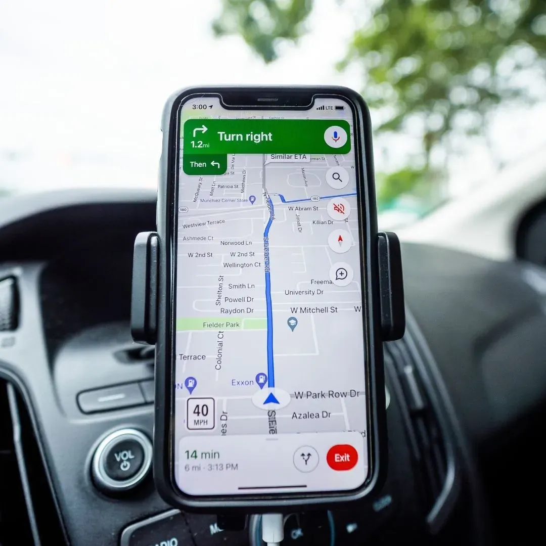
Tech Logistics: Why Google Maps Fails in Korea
Google Maps cannot provide walking or driving directions in South Korea because Korean law restricts high-precision map data from being processed on servers outside the country, and that restriction has not meaningfully changed in 2026 despite a conditional government approval announced in February.
This catches most first-time visitors off guard. Google Maps opens normally, shows pins, and displays restaurant listings and reviews just like it does anywhere else in the world. The failure shows up specifically when you try to get transit directions, a walking route, or a driving path: the app either fails outright or sends you somewhere wrong. The restriction traces back to national security regulations that predate the smartphone era, originally intended to keep detailed geographic data away from foreign servers. In February 2026, Korean regulators granted Google conditional approval to export the detailed map data needed for navigation, but only if the data is processed on domestic servers through a local partner and sensitive sites are blurred. Months later, functional turn-by-turn navigation still had not rolled out.
The practical fix is to skip Google Maps for navigation entirely and use the local alternatives instead:
- Naver Map is the most foreigner-friendly option, with a full English interface, real-time transit information, and detailed place data that includes restaurant menus and bus crowding levels.
- KakaoMap offers similar navigation strength and is widely used alongside Naver by both locals and visitors.
- Kakao T is Korea's dominant ride-hailing and taxi app, and it's effectively required for booking a taxi reliably in Seoul, since flagging one down on the street can be hit or miss during peak hours.
- TMAP rounds out the trio and is a solid choice specifically for driving directions if you're renting a car.
None of these apps are optional extras. Downloading Naver Map and Kakao T before departure, rather than discovering the Google Maps gap after landing at Incheon, saves the kind of confused, station-exit-wandering first afternoon that catches a lot of first-time visitors off guard. Both apps are data-hungry in the way any real-time mapping and ride-hailing service is, which means a fast, reliable connection matters more here than it does in destinations where Google Maps works normally and any generic data plan gets the job done.

Connectivity Breakdown: KT vs. SK Telecom for Tourists
SK Telecom generally offers the fastest and most consistent nationwide coverage, especially in rural areas, on the KTX bullet train, and on Jeju's rural roads, while KT delivers strong urban 5G speeds and notably stable coverage in subways and underground areas. South Korea runs three major mobile networks, and nearly every tourist eSIM connects to one of them:
| Network | Strength | Best for | Providers on MobiMatter |
|---|---|---|---|
| SK Telecom (SKT) | Fastest nationwide 5G, strongest rural and mountain coverage | Jeju road trips, KTX travel, Seoraksan and other national parks | 3, eSIMGo, RoamVault, Sparks, TSimTech, Ubigi |
| KT | Strong urban 5G, stable underground and subway coverage | Seoul, Busan, and Incheon city travel, heavy subway use | — |
| LG U+ | Reliable urban presence, smaller rural footprint | City-focused, budget-friendly tourist bundles | 3, RoamVault, TSimTech, Ubigi |
For most Golden Week, foliage-season, or city-break itineraries, the difference between SKT and KT rarely changes the actual trip. Maps, translation, messaging, and restaurant searches work well on both networks in Seoul, Busan, and other major cities. The gap widens once you leave the city: a day trip to Seoraksan, a road trip around Jeju, or a KTX ride through rural stretches of the country is where SKT's stronger tower density in mountainous and coastal areas becomes noticeable, since South Korea's national parks sit exactly in the terrain where signal density thins out fastest.
A MobiMatter South Korea eSIM running on the SKT network is a practical default for a foliage-focused itinerary that includes national park day trips, since it covers both the dense urban coverage most visitors expect and the rural stability that a Seoraksan or Jeju day trip actually needs. For a trip that stays entirely within Seoul, Busan, and other major cities, either major network handles the load without a noticeable difference.

Stay Connected From Incheon to Naejangsan
Whether the trip is a five-day Seoul foliage run or a two-week loop through Seoul, Busan, and Jeju, sorting out data before departure means the Naver Map download, the Kakao T signup, and the airport transfer all happen the moment you land instead of after a frustrating search for Wi-Fi. MobiMatter's Korea Local eSIM activates by QR code before you leave home, runs on Korea's SKT network for strong 4G and 5G speeds in both cities and national parks, and supports mobile hotspot sharing at no extra cost.
For travelers combining South Korea with a wider Asia itinerary, whether that's Tokyo and Jeju on the same trip or a longer swing through Japan, Taiwan, and Southeast Asia, the Asia-Pacific Regional Plan covers multiple countries on a single profile, so a border crossing between legs of the trip doesn't mean buying and swapping a second eSIM mid-itinerary. Both options activate in minutes, need no physical SIM swap, and skip the passport or ID checks that some local carrier counters still require.
Anyone building a foliage-season trip around a specific park's peak dates should treat the data plan the same way as the Secret Garden ticket or the cable car reservation: lock it in ahead of time so a last-minute forecast check or a Kakao T booking doesn't turn into the first obstacle of the trip.
Frequently Asked Questions
Does Google Maps work at all in South Korea?
It works for basic searches, place listings, and reviews, but it cannot provide walking or driving directions due to Korean data export restrictions, which remained unresolved for everyday travelers as of mid-2026 despite a conditional government approval in February.
What's the best month to see autumn foliage in South Korea?
Late October generally offers the best overlap, since Seoraksan is near or past its peak by then while Seoul, Nami Island, and Gyeongju are approaching theirs, giving a one-week trip the widest window to catch color in multiple locations.
Should I use Naver Map or KakaoMap for navigation in Korea?
Either works well; Naver Map is generally considered the more foreigner-friendly of the two thanks to its English interface and detailed place data, while KakaoMap pairs naturally with Kakao T for booking taxis in the same ecosystem.
Is SK Telecom or KT better for a South Korea eSIM?
SK Telecom generally offers stronger coverage outside major cities, including national parks, rural roads, and the KTX rail line, while KT performs particularly well in dense urban and underground settings, so the better choice depends on whether the trip leans rural or city-focused.
Do I need a Korean phone number to use Kakao T?
Most ride-hailing and mapping functions work with just a data connection and an international phone number for account verification; a dedicated eSIM with reliable data is what actually matters for using these apps smoothly, not a local Korean SIM number.
Can one eSIM cover both South Korea and other Asian countries on the same trip?
Yes, regional Asia-Pacific eSIM plans are built for exactly this, covering multiple countries on a single profile so a border crossing mid-trip doesn't require buying or swapping to a second plan.
- Autumn in Korea
- Blog
About the author
Travel & eSIM writer, MobiMatter
Writes MobiMatter's eSIM and destination guides since 2024, for travellers who want data from the moment they land. Before that, SEO consulting and nearly ten years in analytics at IBM.